Geography Courses
Geography courses can help you learn spatial analysis, cartography, environmental systems, and urban planning. You can build skills in geographic information systems (GIS), data visualization, and understanding demographic trends. Many courses introduce tools like ArcGIS and QGIS, that support mapping and analyzing geographic data, as well as methods for interpreting spatial relationships and patterns.
Popular Geography Courses and Certifications
 Status: New
University of Minnesota
Skills you'll gain: Food Quality Assurance And Control, Nutritional Assessment, Environmental Science
 Status: NewStatus: Free Trial
University of Minnesota
Skills you'll gain: Design Elements And Principles, Plant Operations and Management, Planning, Adaptability, Land Management, Design, Taxonomy, Sustainable Design, Water Resource Management, Life Sciences, Analytical Testing, Environmental Science, Environment and Resource Management, Sustainable Systems, Microbiology, Decision Making, Productivity
 Status: NewStatus: Free Trial
Coursera
Skills you'll gain: Verification And Validation, Spatial Data Analysis, Virtual Environment, Geospatial Information and Technology, Development Environment, Geographic Information Systems, Software Installation, Debugging, Package and Software Management, Software Versioning, Dependency Analysis, Pandas (Python Package), Environment, Scripting, Python Programming, Environmental Regulations, Cross-Channel Marketing
 Status: NewStatus: Free Trial
University of Minnesota
Skills you'll gain: Design Elements And Principles, Plant Operations and Management, Planning, Land Management, Design, Adaptability, Water Resource Management, Environment and Resource Management, Biology
 Status: NewStatus: Free Trial
Arizona State University
Skills you'll gain: Language Learning, Language Competency, Oral Comprehension, English Language, Grammar, Vocabulary
 Status: Free Trial
L&T EduTech
Skills you'll gain: Geospatial Information and Technology, Spatial Analysis, GIS Software, Spatial Data Analysis, Geographic Information Systems, Geospatial Mapping, Construction Engineering, Database Management, Database Management Systems, Construction, Construction Management, ArcGIS, Relational Databases, Visualization (Computer Graphics), Global Positioning Systems, Data Mapping, Building Information Modeling, Scientific Visualization, Engineering, Scientific, and Technical Instruments, Network Analysis
 Status: NewStatus: Free Trial
Skills you'll gain: Spatial Data Analysis, Geographic Information Systems, GIS Software, Spatial Analysis, Geospatial Mapping, Metadata Management, Verification And Validation, Geostatistics, Data Validation, Query Languages, Technical Documentation, Document Management, SQL, Data Import/Export, Visual Design, Pandas (Python Package), Data Analysis, Data Quality, Geospatial Information and Technology, Python Programming
 Status: NewStatus: Free Trial
University of Minnesota
Skills you'll gain: Adaptability, Planning, Plant Operations and Management, Land Management, Environment and Resource Management, Decision Making, Life Sciences, Productivity
 Status: Free Trial
L&T EduTech
Skills you'll gain: Spatial Analysis, GIS Software, Spatial Data Analysis, Geospatial Mapping, Geospatial Information and Technology, Geographic Information Systems, Data Mapping, Building Information Modeling, Global Positioning Systems, Network Analysis, Image Analysis, Data Import/Export, Software Installation, Supervised Learning, Classification Algorithms
 Status: Preview
École Polytechnique Fédérale de Lausanne
Skills you'll gain: Spatial Analysis, Spatial Data Analysis, GIS Software, Geospatial Information and Technology, Geographic Information Systems, Geospatial Mapping, Geostatistics, Interactive Data Visualization, Data Integration, Data Mapping, Augmented Reality, Statistical Analysis, Sampling (Statistics)
 Status: Preview
École Polytechnique Fédérale de Lausanne
Skills you'll gain: GIS Software, Geographic Information Systems, Spatial Data Analysis, Geospatial Information and Technology, Data Modeling, Geospatial Mapping, Databases, Data Store, Spatial Analysis, NoSQL, Data Storage, Database Systems, Database Software, Database Management, Data Storage Technologies, Query Languages, SQL, Relational Databases, Data Manipulation
 Status: NewStatus: Free Trial
Skills you'll gain: Leaflet (Software), Data Visualization, Extract, Transform, Load, Interactive Data Visualization, Datamaps, Data Pipelines, Analytical Skills, Data Presentation, Amazon S3, Dashboard Creation, Amazon Web Services, Spatial Data Analysis, Heat Maps, Apache Airflow, GIS Software, Geographic Information Systems, Metadata Management, Technical Documentation, Geospatial Mapping, Cloud Computing
In summary, here are 10 of our most popular geography courses
- Forages and Pastures: University of Minnesota
- Introduction to Ecological Gardening: University of Minnesota
- Setup Python Geo Stack: Coursera
- Garden Planning and Management: University of Minnesota
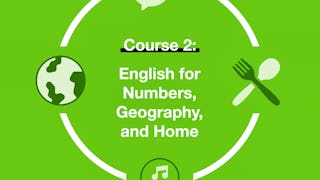
- English for Numbers, Geography, and Home: Arizona State University
- Geospatial Techniques for Engineers: L&T EduTech
- Geospatial Foundations & Python Tooling: Coursera
- A Guide to Garden Plants: University of Minnesota
- Mastering Geospatial Analysis with QGIS: L&T EduTech
- Geographical Information Systems - Part 2: École Polytechnique Fédérale de Lausanne


