Geography Courses
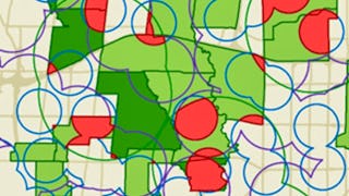
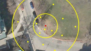
Geography courses can help you learn spatial analysis, cartography, environmental systems, and urban planning. You can build skills in geographic information systems (GIS), data visualization, and understanding demographic trends. Many courses introduce tools like ArcGIS and QGIS, that support mapping and analyzing geographic data, as well as methods for interpreting spatial relationships and patterns.
Popular Geography Courses and Certifications
 Status: NewStatus: Free Trial
Skills you'll gain: Leaflet (Software), Data Visualization, Extract, Transform, Load, Interactive Data Visualization, Datamaps, Data Pipelines, Analytical Skills, Data Presentation, Amazon S3, Dashboard Creation, Amazon Web Services, Spatial Data Analysis, Heat Maps, Apache Airflow, GIS Software, Geographic Information Systems, Metadata Management, Technical Documentation, Geospatial Mapping, Cloud Computing
 Status: Preview
École Polytechnique Fédérale de Lausanne
Skills you'll gain: GIS Software, Spatial Analysis, Geospatial Information and Technology, Geographic Information Systems, Geospatial Mapping, Spatial Data Analysis, Augmented Reality, Data Visualization Software, Data Mapping, Graphic and Visual Design, Color Theory, Database Management
 Status: Free Trial
University of Toronto
Skills you'll gain: Spatial Data Analysis, Spatial Analysis, Geographic Information Systems, Geospatial Mapping, ArcGIS, Geospatial Information and Technology, GIS Software, Data Manipulation, Data Visualization, Data Compilation, Interactive Data Visualization, Data Processing, Data Wrangling, Data Mapping, Data Storytelling, Metadata Management, Data Integration, Graphic and Visual Design, Design Elements And Principles
 Status: Free Trial
University of Toronto
Skills you'll gain: Geographic Information Systems, Geospatial Information and Technology, Geospatial Mapping, GIS Software, Data Mapping, Spatial Data Analysis, Metadata Management, Quantitative Research, Spatial Analysis, Typography, Data Cleansing, Data Manipulation, Design Elements And Principles, Data Import/Export
 Status: Free Trial
Skills you'll gain: Photography, Geospatial Information and Technology, Geospatial Mapping, Geographic Information Systems, GIS Software, Global Positioning Systems, Spatial Data Analysis, Planning, Research, Critical Thinking, Data Import/Export
 Status: Preview
Yonsei University
Skills you'll gain: Spatial Data Analysis, Spatial Analysis, Geospatial Information and Technology, Geographic Information Systems, Geospatial Mapping, GIS Software, Database Management Systems, Big Data, Database Systems, Apache Hadoop, Data Modeling, PostgreSQL, Network Analysis
 Status: Free Trial
L&T EduTech
Skills you'll gain: Civil Engineering, Construction Engineering, Traffic Flow Optimization, Construction, Design Specifications, Engineering Software, Engineering Design Process, Structural Analysis, Materials science, Engineering Calculations, Engineering Analysis, Laboratory Testing
 Status: NewStatus: Free Trial
Skills you'll gain: Data Visualization, Geospatial Information and Technology, Interactive Data Visualization, Scientific Visualization, Data Visualization Software, Geospatial Mapping, Geographic Information Systems, Graphic and Visual Design, Environmental Monitoring, Spatial Data Analysis, Design Elements And Principles, Generative AI, Color Theory, AI Workflows
 Status: Free Trial
Skills you'll gain: Photo Editing, Photography, Post-Production, Photo/Video Production and Technology, Adobe Creative Cloud, Creativity, Editing
 Status: Free Trial
University of California, Davis
Skills you'll gain: ArcGIS, GIS Software, Geographic Information Systems, Public Health and Disease Prevention, Public Health, Land Management, Geospatial Information and Technology, Geospatial Mapping, Spatial Analysis, Epidemiology, Community Health, Spatial Data Analysis, Land Development, Social Determinants Of Health, Emergency Response, Environmental Science, Natural Resource Management, Emergency Services, Business Development, Environment and Resource Management
 Status: Preview
École Polytechnique Fédérale de Lausanne
Skills you'll gain: Spatial Data Analysis, Geospatial Mapping, Geospatial Information and Technology, Geographic Information Systems, Geostatistics, Spatial Analysis, GIS Software, Land Development, Global Positioning Systems, 3D Modeling, Data Mapping, Engineering, Scientific, and Technical Instruments, Survey Creation, Engineering Calculations, Trigonometry, Systems Of Measurement, Numerical Analysis
 Status: Preview
Skills you'll gain: Geographic Information Systems, Geospatial Information and Technology, GIS Software, Geospatial Mapping, Spatial Data Analysis, Spatial Analysis, Global Positioning Systems, Data Analysis, Data Integration, Decision Support Systems
In summary, here are 10 of our most popular geography courses
- Geospatial Visualization, Cloud & Real-Time Pipelines: Coursera
- Systèmes d’Information Géographique - Partie 2: École Polytechnique Fédérale de Lausanne
- GIS, Mapping, and Spatial Analysis Capstone: University of Toronto
- GIS Data Acquisition and Map Design: University of Toronto
- Scout Like a Pro: Find Landscape Photography Locations: Skillshare
- Spatial Data Science and Applications: Yonsei University
- Highway Geometry and Pavement Design: L&T EduTech
- Visualization, Web Mapping & Cloud GIS: Coursera
- Landscape Photography: Capture the Beauty of Planet Earth: Skillshare
- GIS Applications Across Industries: University of California, Davis


