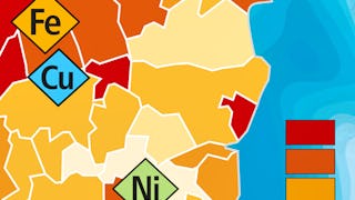
GIS Courses
GIS courses can help you learn spatial analysis, cartography, remote sensing, and data visualization techniques. You can build skills in geographic data management, interpreting satellite imagery, and creating interactive maps. Many courses introduce tools like ArcGIS and QGIS, that support analyzing geographic information and presenting findings effectively. You’ll also explore applications in urban planning, environmental monitoring, and disaster management, allowing you to apply your knowledge in various practical contexts.
Popular GIS Courses and Certifications
 Status: Free Trial
Case Western Reserve University
Skills you'll gain: Geostatistics, Exploratory Data Analysis, Spatial Data Analysis, Spatial Analysis, Geospatial Mapping, Geospatial Information and Technology, Statistical Methods, Statistical Modeling, R Programming, Statistical Analysis, R (Software), Probability & Statistics, Descriptive Statistics, Data Analysis, Data-Driven Decision-Making, Correlation Analysis, Data Validation, Simulations, Histogram, Box Plots
 Status: Free
École normale supérieure
Skills you'll gain: Peer Review, Statistical Visualization, Geospatial Mapping, Data Mapping, Graphic and Visual Design, Geospatial Information and Technology, Graphical Tools, GIS Software, Data Presentation, Color Theory, Layout Design, Descriptive Statistics, Design Elements And Principles
 Status: Free Trial
Skills you'll gain: SAS (Software), Forecasting, Spatial Data Analysis, Data Visualization Software, Data Mapping, Interactive Data Visualization, Time Series Analysis and Forecasting, Trend Analysis, Predictive Analytics, Geospatial Mapping, Data Analysis, Geospatial Information and Technology, Data Wrangling, Geographic Information Systems, Advanced Analytics, Analytics, Data Transformation, Statistical Programming
 Status: Free Trial
Case Western Reserve University
Skills you'll gain: Geostatistics, Exploratory Data Analysis, Spatial Analysis, Spatial Data Analysis, Geospatial Information and Technology, Data Cleansing, Data Analysis, Statistical Modeling, Statistical Analysis, Oil and Gas, Statistical Reporting, Estimation, Simulations, Simulation and Simulation Software, Data Integration
 Status: Preview
École Polytechnique Fédérale de Lausanne
Skills you'll gain: GIS Software, Spatial Analysis, Geospatial Information and Technology, Geographic Information Systems, Geospatial Mapping, Spatial Data Analysis, Augmented Reality, Data Visualization Software, Data Mapping, Graphic and Visual Design, Color Theory, Database Management
 Status: NewStatus: Preview
University of Glasgow
Skills you'll gain: Responsible AI, Generative AI, Generative Model Architectures, AI literacy, Risking, AI Integrations, Data Ethics, ChatGPT, Risk Management Framework, Data Science, LLM Application, Large Language Modeling, Artificial Intelligence and Machine Learning (AI/ML), Data Security, Statistical Methods
 Status: Preview
École Polytechnique Fédérale de Lausanne
Skills you'll gain: Spatial Data Analysis, Geospatial Mapping, Geospatial Information and Technology, Geographic Information Systems, Geostatistics, Spatial Analysis, GIS Software, Land Development, Global Positioning Systems, 3D Modeling, Data Mapping, Engineering, Scientific, and Technical Instruments, Survey Creation, Engineering Calculations, Trigonometry, Systems Of Measurement, Numerical Analysis
 Status: NewStatus: Free Trial
Coursera
Skills you'll gain: GIS Software, Geospatial Mapping, Geographic Information Systems, Spatial Data Analysis, Spatial Analysis, Geospatial Information and Technology, Database Systems, SQL, PostgreSQL, Data Validation, Query Languages, Data Integration, Data Mapping, Scripting, Performance Tuning
 Status: NewStatus: Free Trial
Coursera
Skills you'll gain: Verification And Validation, Spatial Data Analysis, Virtual Environment, Geospatial Information and Technology, Development Environment, Geographic Information Systems, Software Installation, Debugging, Package and Software Management, Software Versioning, Dependency Analysis, Pandas (Python Package), Environment, Scripting, Python Programming, Environmental Regulations, Cross-Channel Marketing
 Status: NewStatus: Free Trial
Coursera
Skills you'll gain: Geospatial Information and Technology, Cloud Deployment, Geospatial Mapping, Spatial Data Analysis, Cloud Computing, Data Validation, Geographic Information Systems, Image Quality, Data Manipulation, Spatial Analysis, Data Transformation, Cloud Platforms, Verification And Validation, Data Import/Export, Metadata Management, Data Integrity
 Status: Free Trial
Skills you'll gain: Generative Engine Optimization (GEO), Content Performance Analysis, Content Optimization, Google Gemini, Generative AI, Content Strategy, Gemini, Content Marketing, AI Workflows, ChatGPT, Google Analytics, Responsible AI, Content Creation, Data-Driven Marketing, AI literacy, Large Language Modeling, Automation, No-Code Development, Language Interpretation, Translation, and Studies
 Status: Free Trial
Skillshare
Skills you'll gain: Photography, Photo Editing, Photo/Video Production and Technology, Visual Storytelling, Storytelling, Geospatial Information and Technology, Geospatial Mapping, Geographic Information Systems, GIS Software, Global Positioning Systems, Creativity, Spatial Data Analysis, Post-Production, Planning, Research, Adobe Creative Cloud, Design Elements And Principles, Aesthetics, Critical Thinking, Editing


