Results for "geospatial mapping"
 Status: New
Skills you'll gain: Data Storytelling, Data Presentation, Data Visualization, Interactive Data Visualization, Statistical Visualization, Dashboard, Data Visualization Software, Dashboard Creation, Looker (Software), Data Literacy, Health Informatics, Technical Communication, Spatial Data Analysis, Data Analysis, Health Technology, Geospatial Mapping, Health Care, Web Content Accessibility Guidelines

Included with Coursera Plus
University of Colorado Boulder
Skills you'll gain: Machine Controls, Robotics, Control Systems, Engineering, Scientific, and Technical Instruments, Applied Mathematics, Linear Algebra, Python Programming, Algorithms
Included with Coursera Plus
Build toward a degree
4.6Rating, 4.6 out of 5 stars16 reviews Status: New
Coursera
Skills you'll gain: Data Flow Diagrams (DFDs), Diagram Design, Data Mapping, Data Literacy, Software Design Documents, Data Pipelines, Data Visualization, Dataflow, Technical Communication, Data Store, Data Transformation
Included with Coursera Plus

Skills you'll gain: Journey Mapping, User Experience, Design Research, Design Strategies, UI/UX Strategy
Included with Coursera Plus

Case Western Reserve University
Skills you'll gain: Geostatistics, Exploratory Data Analysis, Spatial Analysis, Spatial Data Analysis, Geospatial Information and Technology, Data Cleansing, Data Analysis, Statistical Modeling, Statistical Analysis, Oil and Gas, Statistical Reporting, Estimation, Simulations, Simulation and Simulation Software, Data Integration
Included with Coursera Plus
 Status: New
Skills you'll gain: SketchUp (3D Modeling Software), Spatial Data Analysis, Architectural Drawing, Geospatial Mapping, Spatial Analysis, AutoCAD, Visualization (Computer Graphics), Data Mapping, Graphic and Visual Design, 3D Modeling, Technical Communication, Color Theory, Microsoft Office
Included with Coursera Plus
Skills you'll gain: ArcGIS, GIS Software, Spatial Data Analysis, Data Visualization, Geographic Information Systems, Geospatial Information and Technology, Geospatial Mapping, Spatial Analysis, Data Import/Export, Data Mapping, Data Integration, Data Management
Included with Coursera Plus
4.5Rating, 4.5 out of 5 stars15 reviews
Skills you'll gain: Spatial Data Analysis, Spatial Analysis, Geographic Information Systems, Geospatial Information and Technology, Geospatial Mapping, GIS Software, Data Analysis, Data Visualization, Analytics, Interactive Data Visualization, Google Cloud Platform, Network Analysis, Query Languages
Included with Coursera Plus
4.3Rating, 4.3 out of 5 stars16 reviews
Skills you'll gain: Data Mapping, Microsoft Azure, Data Transformation, Data Pipelines, Extract, Transform, Load, Dataflow, Data Processing, Data Integration, Data Storage, Cloud Storage
Included with Coursera Plus
4.8Rating, 4.8 out of 5 stars8 reviews
Skills you'll gain: Process Analysis, Process Modeling, Business Process, Business Analysis, Process Mapping, Process Management, Process Flow Diagrams, Business Process Modeling, Business Modeling, Stakeholder Management, Stakeholder Analysis, Computer Literacy
Included with Coursera Plus
4.5Rating, 4.5 out of 5 stars7.6K reviews
Skills you'll gain: Process Mapping, Process Design, Process Flow Diagrams, Diagram Design, Data Visualization, Graphic Design, Account Management, Marketing
Included with Coursera Plus
4.3Rating, 4.3 out of 5 stars12 reviews
Skills you'll gain: Interactive Data Visualization, Exploratory Data Analysis, Dashboard, Dashboard Creation, Data Presentation, Data Integration, Heat Maps, Datamaps, Spatial Data Analysis, Data-Driven Decision-Making, Decision Support Systems, Business Intelligence Software, Spatial Analysis, Geospatial Information and Technology, Data Mapping
Included with Coursera Plus
In summary, here are 10 of our most popular geospatial mapping courses
- Healthcare Data Visualization and Decision Support: SkillUp
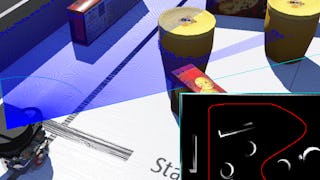
- Robotic Mapping and Trajectory Generation: University of Colorado Boulder
- Map Data Flows Fast: Coursera
- Mapping the Mission: User Personas & Journey Design in Figma: Coursera
- Case Studies in Geostatistical Modeling : Case Western Reserve University
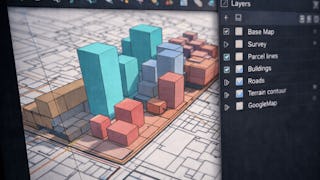
- Apply Urban Scale Mapping Techniques Using SketchUp: EDUCBA
- ArcGIS for Beginners: Mapping Urban Green Spaces: Coursera
- Getting Started with BigQuery GIS for Data Analysts: Google Cloud
- Create Mapping Data Flows in Azure Data Factory: Coursera
- Business Analysis & Process Management: Coursera


